Geophysical Services
Geophysical Surveys play a key role in any development activities and are almost invariably used as a tool for investigation prior to commencement of any major engineering work.
Sometimes geophysical surveys are supported by ground trothing such as Geotechnical Investigations which involves drilling of borehole giving an insight into the underlying strata. At times, an integrated approach combining geophysical and geotechnical investigations may be the best solution for arriving at the desired results.
Geophysical Surveys for a particular project can be carried out at various stages of activities beginning from initial planning of a project till the completion of engineering/exploration activities.
Various geophysical methods such as electrical, electro-magnetic, gravity, magnetic, magneto-telluric, seismic are being currently used for mapping subsurface geology. Each of the above methods is aimed for fulfilling different objectives.
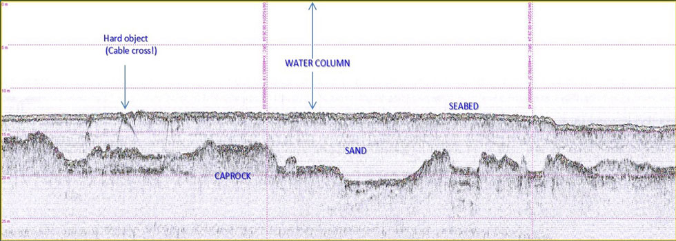
Out of the above methods, seismic methods are the most widely used of all the geophysical methods in mainly geological surveys, mineral exploration, various engineering activities and petroleum exploration activities. The main advantage is that it provides the most accurate rendition of the geometry of subsurface layers.
In marine applications, often seismic surveys are combined with other surveys such as bathymetric, side scan sonar and magnetometer surveys to get complete information of the seabed and sub-seabed in the area of interest.